Boundary Maps for
2002 General Election
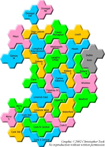
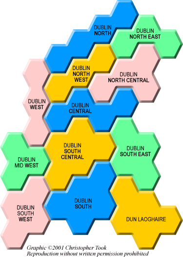
The maps below show a diagrammatic representation of the Dáil constituencies for the 2002 General Election to the 29th Dáil. The area of each constituency is in direct proportion to the number of Dáil seats for that constituency. Boundaries are also preserved between most constituencies - ie each constituency in the diagram borders all and only the same constituencies as it does geographically, except in the Limerick area. As far as possible, the geographical position of constituencies has been maintained. The "Dublin Area" in the first map is not in proportion - a separate map for these constituencies is shown below.

The first map is unchanged following the 1998 Constituency Commission Report, as this report had only minor effects on seats outside Dublin. Both the 1997 General Election for the 28th Dáil and the 2002 General Election for the 29th Dáil were held using these boundaries. The map for the 1998 revision of the Dublin constituencies is also shown below.